Distance: 6 miles out and back
Elevation at the May Lake Trailhead: 8700 ft
Elevation Gain: 2000 ft
During our second trip to Yosemite amid pandemic, Arnav chose Mount Hoffman or Hoffman Peak for us to climb. We all have our favorite spots in Yosemite. Dharmesh likes the valley and any hikes around the waterfalls; I like the high country and the lakes, and Arnav’s idea of hiking, in general, is climbing a mountain peak, be it anywhere in the park. Anuj is open to all, but he tends to like what his brother selects.
We looked it up and read that it was 6 miles hike, which is not that much. We were well aware of the altitude factor and the quick elevation gain, but we still felt that we would be able to manage this one as a day trip.
We started driving at 6 am; by the time we got to the trailhead and started hiking, it was 10.30 am. We were a little behind in the schedule, but we knew we were going to be okay. We also saw that there were 30% chances of thunderstorms in the afternoon. Considering that, we started moving quickly.


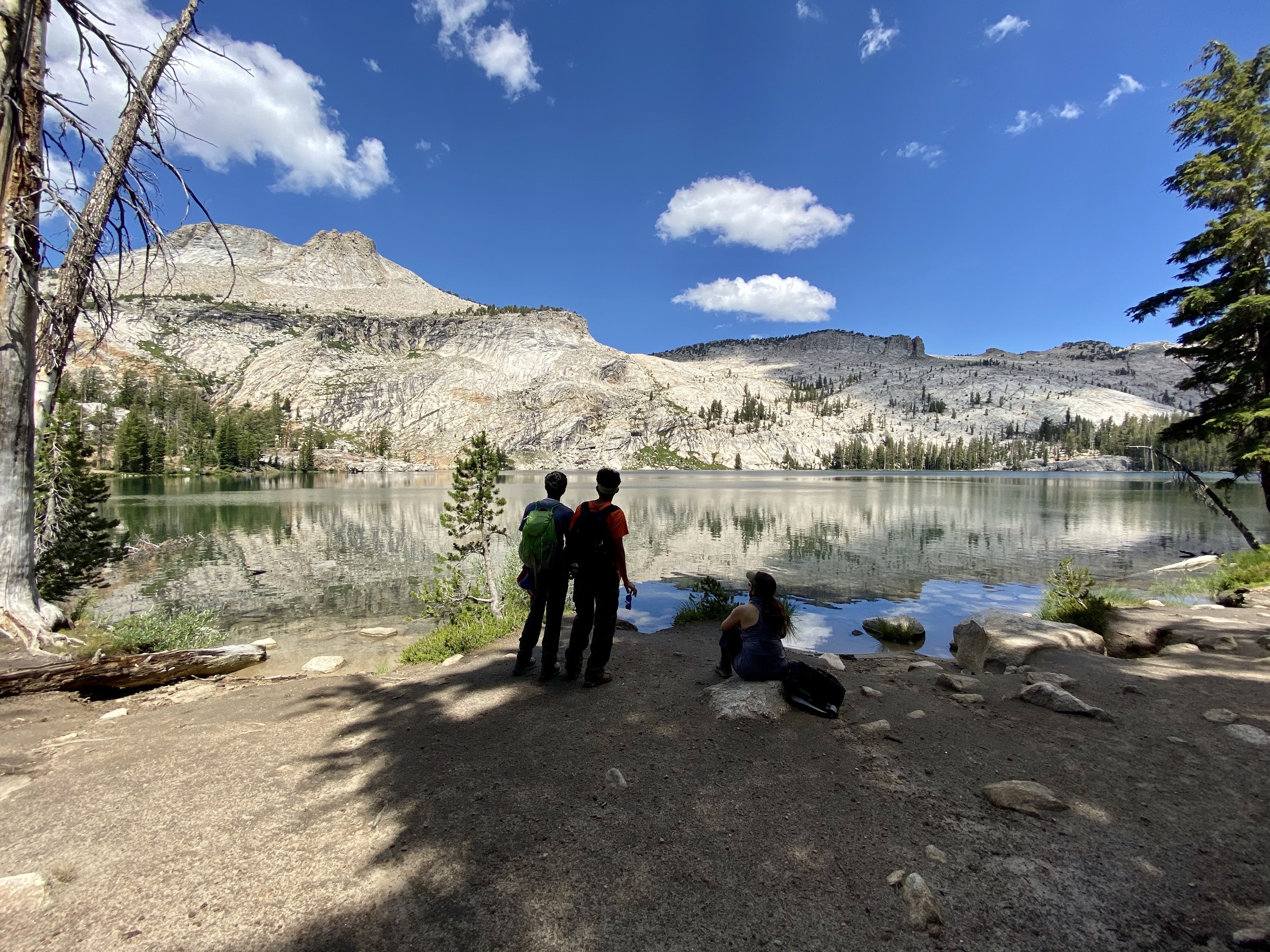
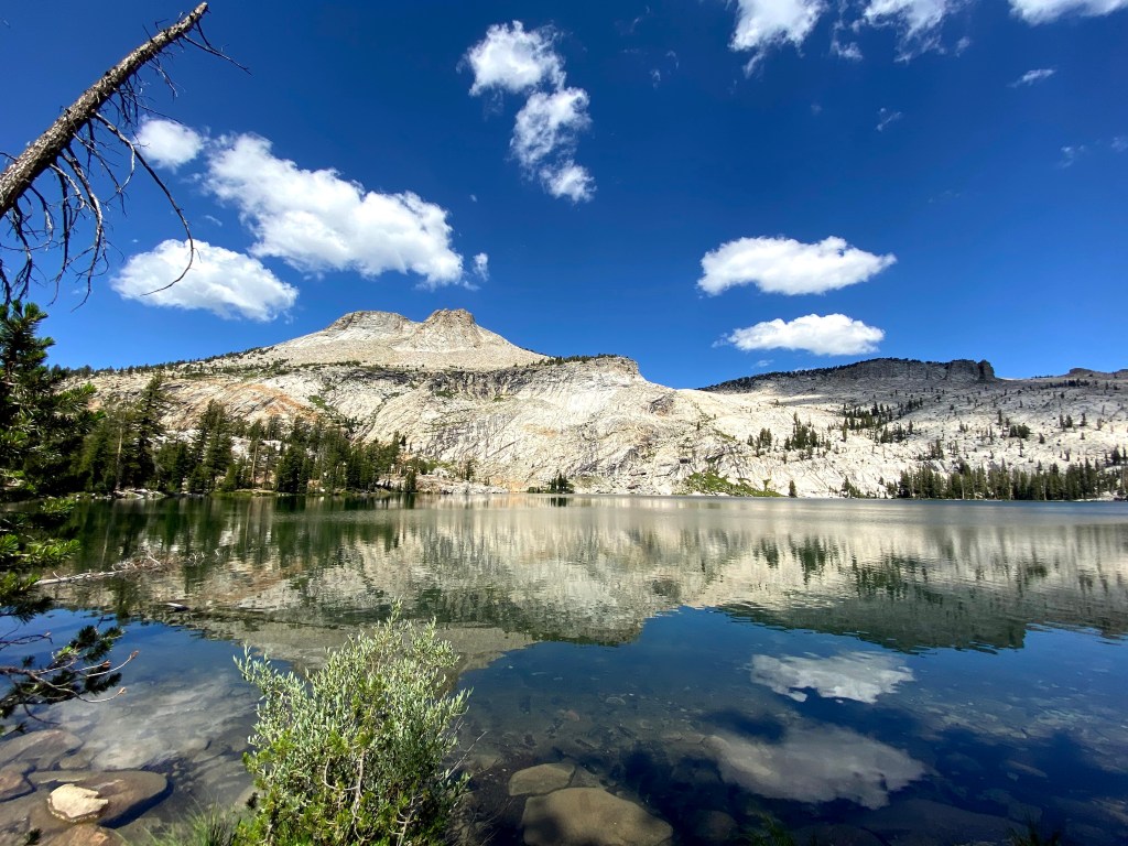
The first mile and half was a gentle climb through the woods. Beautiful wildflowers lined our path. May Lake came quicker than we thought. We crossed the campground and got to the lake to catch the views. Though all the lakes in Yosemite’s high country are beautiful, this one was special! It was pristine and had a gorgeous backdrop of Hoffman Peak. We took a long break here to admire the views. The Peak looked tall and steep! We had only gained 500 ft of elevation so far, which means that we needed to climb 1500 ft in 1.5 miles. That’s a lot but shouldn’t be too bad, we all thought.
It was almost 11.45 am when we started the actual climb for the summit. We moved further, half more mile in, the trail wasn’t getting steep, we started worrying now. There were no trail signs or markers; we were just following the trail. Finally, we encountered the marker but we didn’t see Hoffman peak listed in it. There was a solo backpacker coming from the opposite direction, we asked him, he said he was coming from ten lakes area, which is definitely not where we needed to go. We knew were not on the right trail. We headed back to the campground, we asked someone there and they showed us another direction. Basically, the trail to the peak goes from the left side of the lake and not the right. We knew that we had lost 45 minutes to an hour by now.
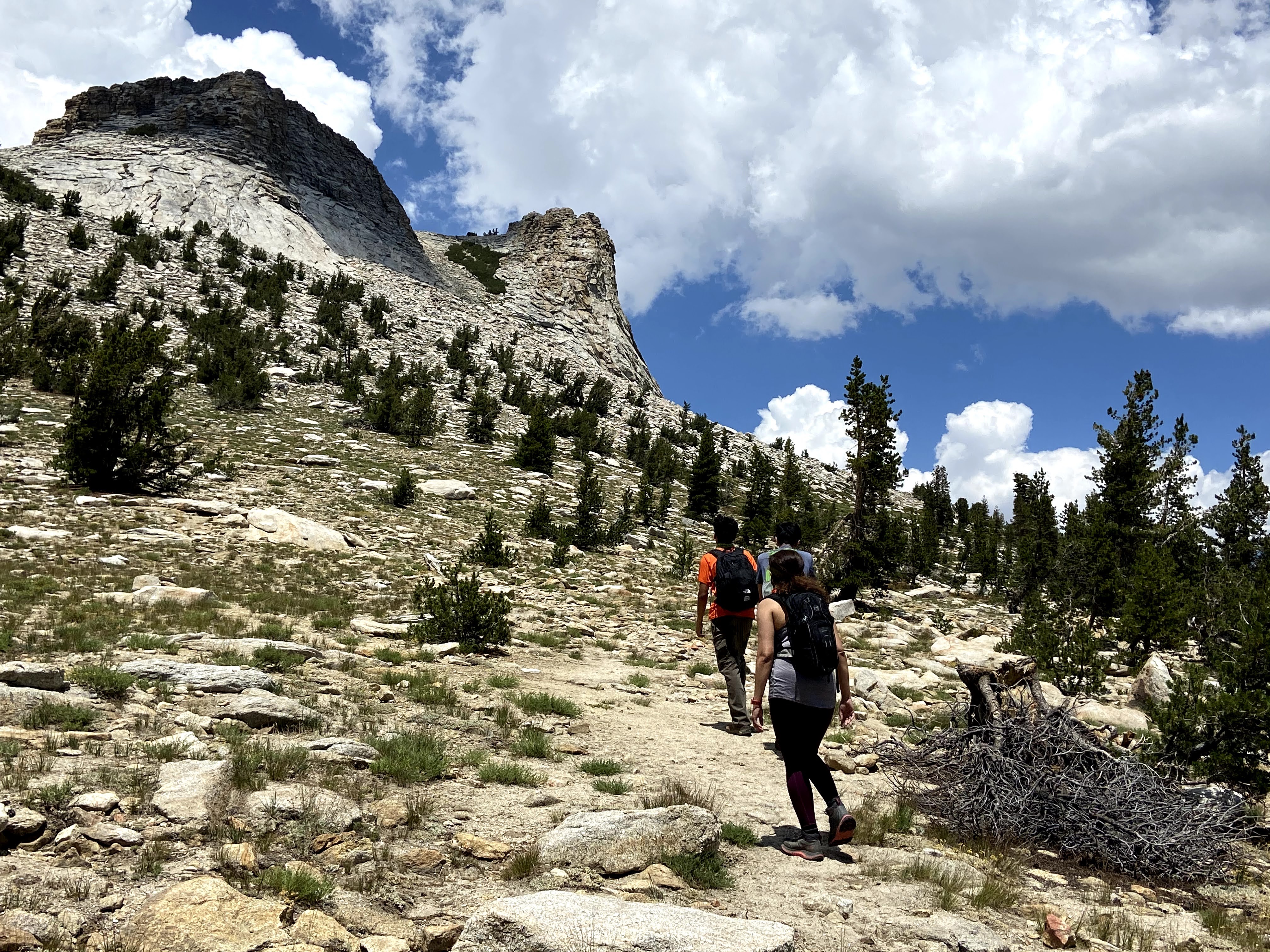
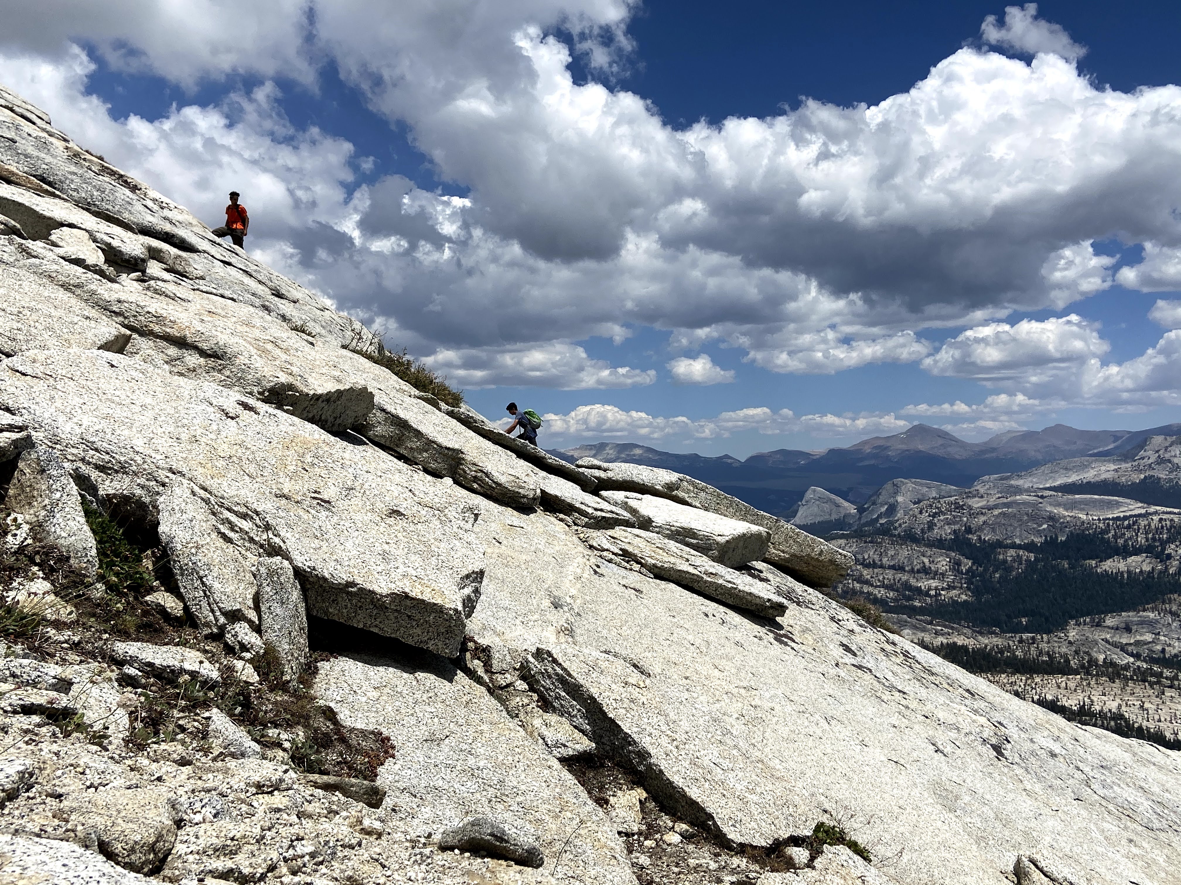
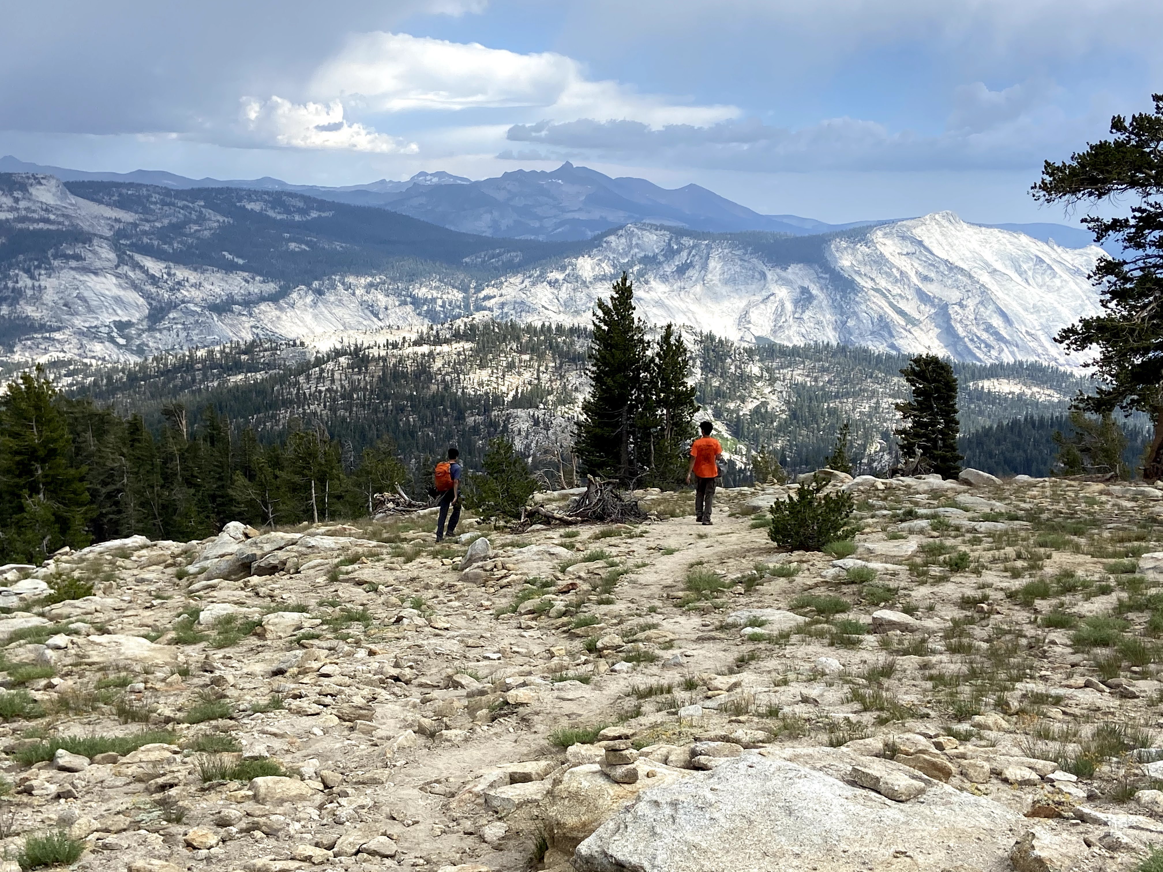
The trail started gaining elevation really quick, within half a mile, we soon passed the treeline. There was no defined trail from here on, we were on our own trying to figure out our way to the top. There were random piles of rocks left as trail markers by previous hikers, we started following those whenever we saw them. Breathing was harder due to the elevation and thinning air, and 30-45 degrees of the steady climb was not easy at that altitude.


Finally, we reached the point where it looked like we were at a base of the peak, and if we climbed another quarter mile we would be up! But the slop ahead of us was 45 degrees steep, and I just stood there looking up the peak and trying to see if there were any markers defining easier way to get to the top. Arnav and Anuj on the other hand got super excited and started running up the slope. Dharmesh got nervous just watching them ascending on steep granite slope. We watched them making sure they were safe and we moved to our left where there were more boulders for support. We made it to the side of the peak in half an hour but didn’t see any other way going up so thought the trail to the top must be from behind the visible peak. There was a defined trail on the left which we started following. Soon, another taller peak came to the view which was further out on the left. We asked the hikers who were coming back, and they said the actual peak was the one far behind and much higher.

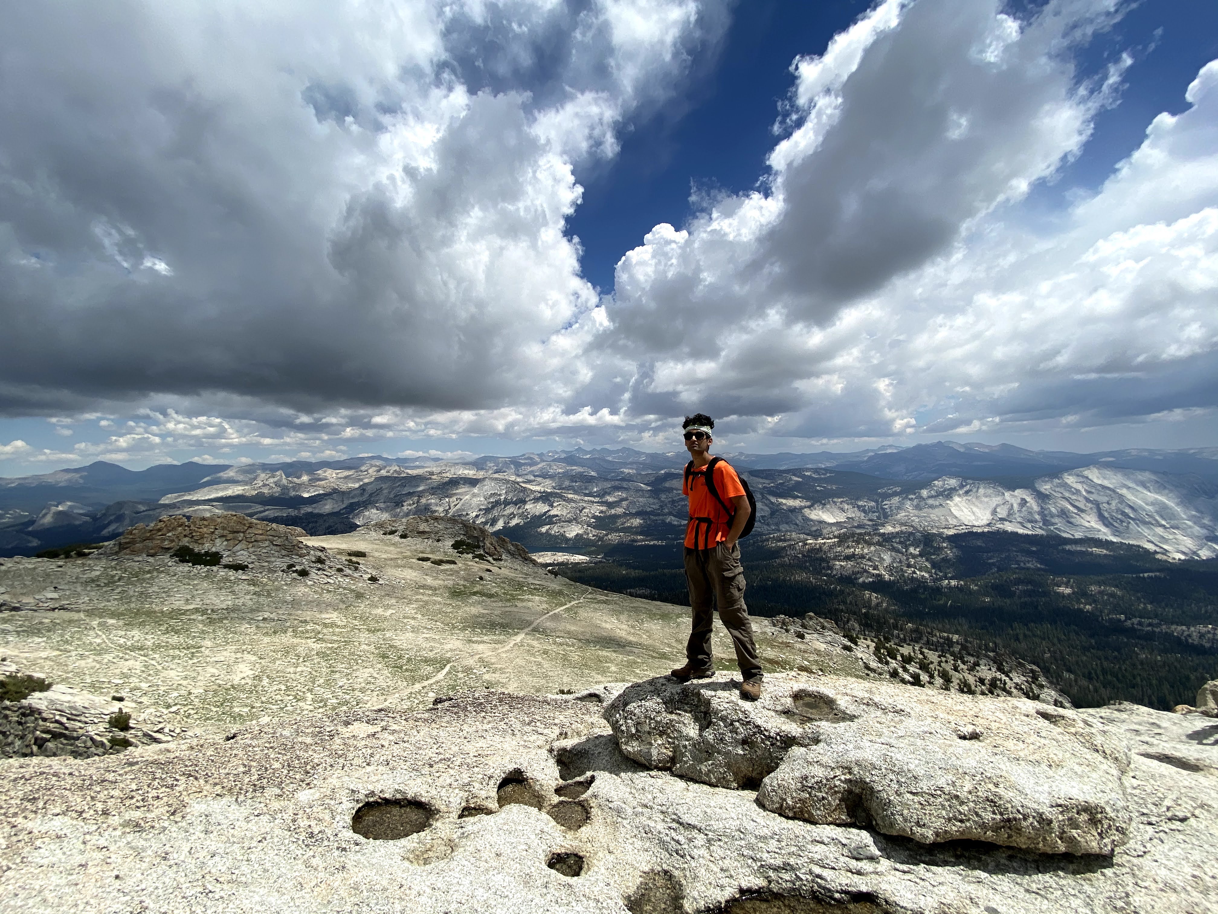
We now realized that we at least had another hour before we would make it to the actual Peak. We started walking towards the mountain. The iconic landmarks of the Yosemite started getting visible now, we now could see the half dome and the clouds rest in the distance.
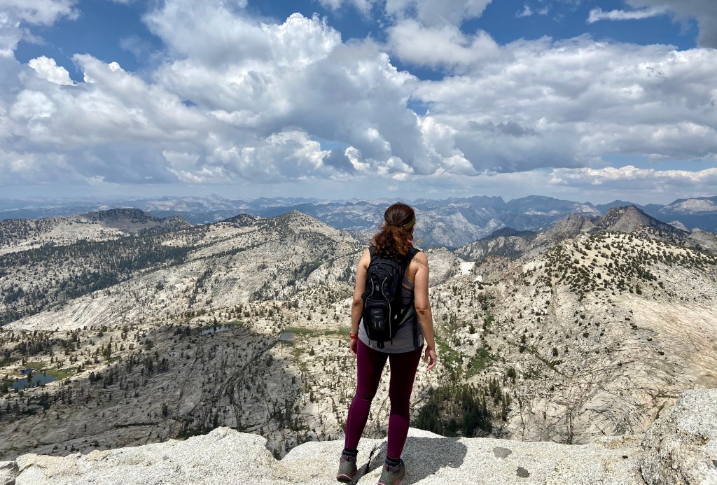
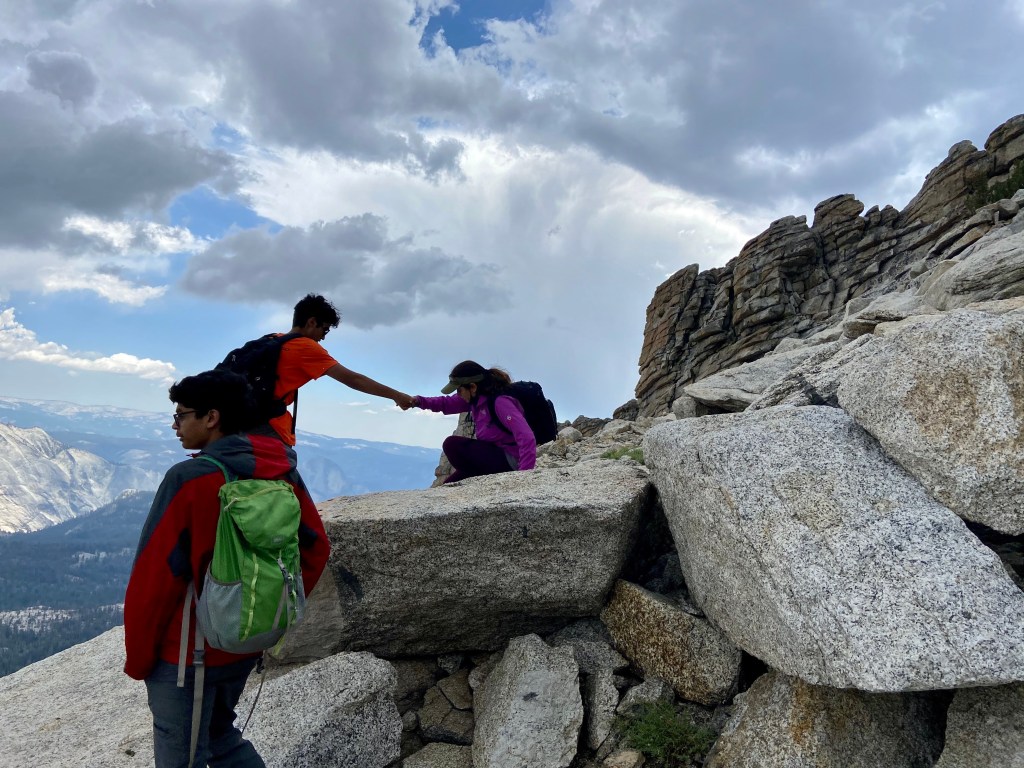
Finally, we reached underneath the actual peak. There was a last steep climb to the summit. It was basically a huge pile of large boulders. With no defined path in sight, we started climbing tall boulders. I needed help in climbing some of those. This was intense but a lot of fun! Kids were already up at the peak waiting for us. We finally made it up by 1.45ish.
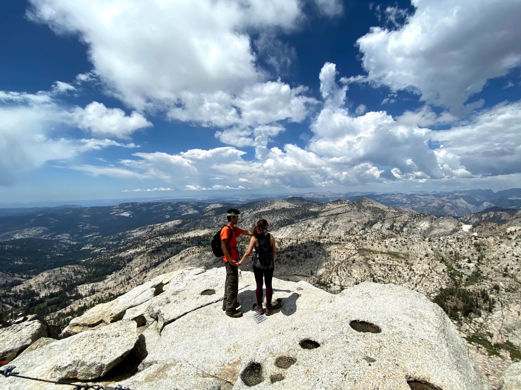
It was time to enjoy rewards now. This was one of those rarest peaks from where you get to see unobstructed 360 degrees of the panorama. With clear visibility of the entire Yosemite Valley in the distance, and views of May Lake, Tenaya Lake, Tuolumne, the Cathedral and Clark Ranges, Cloud’s Rest, and Half Dome – all of it in one panorama was breathtaking. It was 2.15 pm by now and we passed our turnaround time of 2 pm, so we decided to eat quickly and start descending. We saw thick dark clouds were starting to roll in. The hiker at the top who was on his way back warned us about the upcoming thunderstorms. He apparently was camping at May Lake Campground and said the storm night before came with a gusty wind of 50 miles an hour and was very frightening.

We found a spot to eat our lunch quickly, it started to drizzle as we took the first bite of our burrito. We knew we needed to be off the steep granite slope before it would start getting wet and slippery. We gulped a few bites down and packed the rest of our lunch up. We started making fast but careful descent off the main peak and the second peak. Thunderstorms were getting louder with visible lightning bolts and rain, we got our rain jackets out and kept on going down. We lost our way on the way down but quickly realized it as we started losing the sight of May Lake. Thankfully, we were able to find our trail back.
In another hour or so, we reached May lake. We knew we were safe now. The rain got lighter but the lightning got brighter and the thunders got louder. We decided to sit at the lake to enjoy the natural phenomena and finish our lunch. We enjoyed the thunders for a good 20 minutes while we finished eating.
We finally headed back to the trailhead and made it to our car by 5 pm. Who knew 6 miles hike would take us 6 hours to finish. Good thing was that we were prepared for the storm and we were following our timeline in which we had kept plenty of time for a safe return.